Saturday, August 8, 2015
John flew the drone over some soybean fields on Friday. In particular, he examined Freddie, Nellie, and Burke. If you merely did the ‘drive by’ windshield analysis of these soybeans, you’d feel pretty good about those fields’ potential. However, the view from above yields a different perspective, and lowers our expectations of final results.

Here, above the Nellie farm, you can see damage to the soybeans that is not apparent as you drive by on US 50. This view is looking north, and you can see White River’s curving stream across the north end of this field. The bare U-shaped stripe to the right is “wolf bayou’, where the river water flowed in to submerge the bean crop. Even though there is a levee along the river, it ends downstream and allows the flood waters to ‘back into’ the field here. At least the levee stops the incredible damage from direct current flowing out of the river at flood stage.
Even though it is over one-half mile west of White River, our Freddie farm saw extensive damage from the 21+foot flood crest. It has lost about half the 310 acres planted here. The flood waters came in late June, and remained here until early August… in fact you can see in these 2 pictures that some water still remains to this day! You can see more images of this flood in a June 23 video on our YouTube page. Click on this link to compare the June images to this one from August 7.

Looking south across the flood damage at the Freddie farm.

Looking east across the north and center part of Freddie, you can still see river water that has yet to flow out and dry up.
The HD capability of the GoPro Hero 3+ camera attached to the DJI Phantom 2 drone gives us a more accurate look into the soybean crop canopy. When we view a photo taken straight down into the soybeans, we can ‘zoom in’ to see almost through the canopy into the lower leaves of the plants. We can see the damage done to the lower parts of plants that were not completely submerged in the flood waters. And it is easy to see the better health of plants that did not have flood water in/on them at all.

Looking straight down into the soybean crop canopy at Nellie. You can see some of the lower leaves on the plants that have had muddy water on them. The flood was not deep enough to completely submerge the plants, and these survived. The new growth at the top is more healthy looking and should put on some pods of soybeans.

Here, you’re looking straight down into some healthier soybeans that were in an area of the field high enough that flood waters did not reach them. Notice the darker green color? Zoom in on this picture and you can even spot some pods developing on the bean stalks.
Not every location is ‘sad news’. We have mostly happy views of other farm locations such as VanVleet, Holscher, Downen, Burke, and Huey Hills.

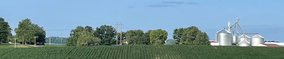
Looking north across the main field at Burke, gives us a reassurance that there should be some fun days during soybean harvest this fall!
Even though some of the aerial photos give us a diminished optimism for the final 2015 yield result, the ability to capture these views does give us valuable information about the progress of the crop at this point in the growing season. The Phantom 2 is ‘earning its keep’, so to speak.
Harvest15 is just a few weeks away now.